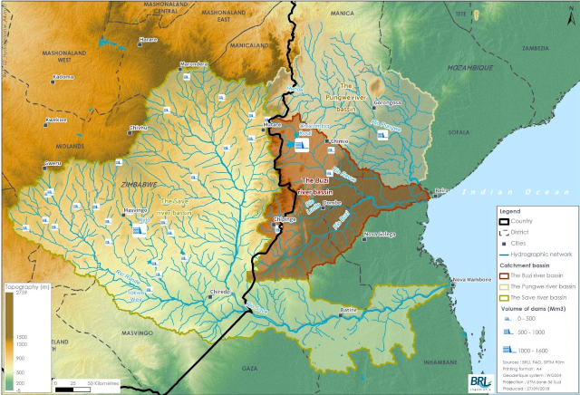
Situation map of the Pungwe, Buzi, and Save basins
The Pungwe, Buzi, and Save basins, collectively known as BUPUSA, are exclusively shared by the two countries and drain into the Indian Ocean. These 3 basins, collectively known as BUPUSA, are located along the Beira corridor, an important economic corridor that links Beira harbour to the hinterland, with associated impacts on the environment (pollution from mining activities, intensive agriculture, deforestation, etc.). Populations also suffer high vulnerability to climate hazard (floods, droughts, cyclones) that is likely to increase with climate change aggravation.
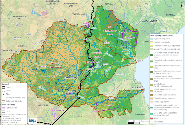
Land cover map of the Pungwe, Buzi, and Save basins